

 Kendriya Vidyalaya Admission 2024-25 for Class 1 [Apply Online from 1.1.2024 to 15.4.2024]
Goa District Map PDF Download
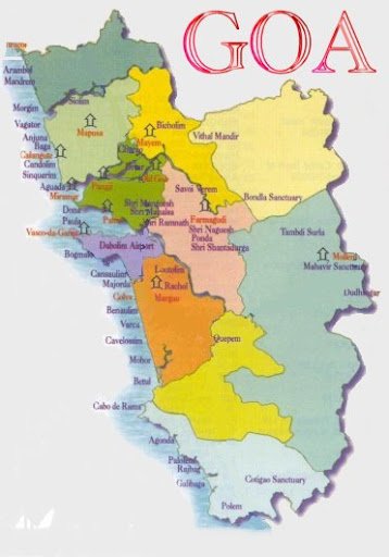
North Goa:
North Goa is one of the Two districts that constitute the State of Goa. The District has an area of 1736 sq kms and is bounded by Sindhudurg and Kolhapur districts of Maharashtra state to the North and East respectively, by South Goa District to the south, and by the Arabian sea to the west.
South Goa:
South Goa District covers the entire southern part of Goa state. Arabian sea is to the west of district, North Goa district to the North and Uttar Kannada district of Karnataka in the East and South.The total geographical area of the district is 1966 sq kms.
GOA CAPITAL: Panaji
GOA LANGUAGE: Konkani
GOA AREA: 3702 km2
Goa’s population is 1458545 with 739140 Males and 719405 Females. The growth of 14.8 per cent, during 1991 to 2000, is lower than the 16.08 per cent recorded during 1981 to 1990.
The sex-ratio (number of females per thousand males) in Goa is 973 in 2011 compared to 967 in 1991.The density of population per sq km in Goa is 364 in 2001 as compared to 316 in 1991. North Goa has a much higher density (437) as compared to South Goa (300). The national figure is 324.
The literacy rate is 80 per cent. 83.3 per cent of the male and 76.4 per cent of the female population is literate.64.68 per cent of the population is Hindu, 29.86 per cent is Christian and Muslims are a minority of 5.25 per cent.
Around 0.15 to 0.2 million of the total population of 13,43,998 are immigrants from around India who have settled down in Goa.
Goa District Map PDF Download – Click Here